Menu
Categorías
CLOSE
Categorías
- TVC
-
- Videovigilancia
- Fuentes de Energía
- Redes
- Audio & Video
- Acceso & Asistencia
- Alarmas & Intrusión
- Cableado Estructurado
-
- Categoría 6
- Faceplate Y Cajas Universales
- Organización y fijación de cables
- Fibra óptica : Monomodo
- Racks y Gabinetes
- Categoría 5e
- Categoría 6A
- Herramienta
- Cables
- Accesorios Y Herramientas Fibra Óptica
- Accesorios - Cableado Estructurado
- Fibra óptica : Multimodo
- Gabinetes
- Charolas y Organizadores
- Racks
- Jacks y Conectores
- Tierras Físicas y Pararrayos
-
- Varios
- Incendio
- Almacenamiento
- Switches PoE
- Jumpers
- Servidor de Administración
- Switches
-
- Videovigilancia
-
- Cables y Conectores
- Energía
- Cámaras IP y NVRs
- Accesorios Generales
-
- Transceptores de Video
- Gabinetes para Cámaras
- Iluminadores IR y de Luz Blanca
- Montajes y Brackets para Cámaras
- Gabinetes de Acero para DVR y NVR
- Cajas de Interconexión
- Controladores PTZ
- Probadores de Video
- Lentes
- Micrófonos
- Kits Extensores, Convertidores , Divisores, HDMI, VGA, DVI
- Partes o Refacciones
- Accesorios para Computadora y Smartphones
- Accesorios Ethernet y Fibra
-
- Kits- Sistemas Completos
- Videoporteros e Interfonos
- Cámaras y DVRs HD TurboHD / AHD / HD-TVI
- Protección Contra Descargas
- Videograbadoras Móviles, Dash Cams y Body Cams
- Servidores / Almacenamiento
- Monitores Pantallas y Mobiliario
- Software VMS y Analíticas
- Drones, Robots e Industrial
- Conectividad
-
- Radiocomunicación
-
- Accesorios para Motorola
- Accesorios para ICOM
- Accesorios para KENWOOD
- Accesorios para Hytera (HYT)
- Accesorios para Otras Marcas
- Radios ICOM Aéreos
- Aplicaciones y Soluciones
- Antenas
- Protección Contra Descarga
- Equipo de Laboratorio
- Energía
- Cables
- Torres y Mástiles
- Radios ICOM WiFi
- Radios Amateur
- Radios Marinos
- Radios Comerciales ICOM / KENWOOD / TXPRO
- Sistemas Troncalizados
- Racks y Gabinetes
- Adaptadores
- Filtros y Sistemas en RF
- Conectores
- Refacciones
- Cobertura Celular 5G, 4G, 3G y Voz
- Radios LTE
- Soluciones Marinas
- Soluciones RITRON
- Radio Satelitales
- Radios Comerciales TXPRO
- Conectividad
-
- Redes e IT
- IoT / GPS / Telemática y Señalización Audiovisual
-
- Barras de Luz / Torretas Vehiculares
- Mini Barras Vehiculares
- Estrobos / Burbujas Vehiculares
- Luces Auxiliares Vehiculares
- Luces Auxiliares para Motocicletas
- Barras de Luz para Interior Vehiculares
- Barras Directoras de Tráfico Vehiculares
- Sirenas / Bocinas y Controladores Vehiculares
- IoT, GPS y Telemática
- Videograbadoras Móviles y Portátiles
- Luces Auxiliares para Ambulancias
- LoRa
- Luces para Montacargas y Grúas
- Luces Auxiliares para Vehículos Todo Terreno
- Luces / Bocinas para la Industria y Edificios
- Luces Auxiliares para Bicicletas
- Sensores
- Conectividad
- Accesorios Vehiculares
-
- Energía / Herramientas
-
- Baterías y Cargadores
- Energía Solar
-
- Accesorios / Cables / Jumpers
- Controladores de Carga MPPT
- Controladores de Carga PWM
- Montajes Completos para Módulos
- KIT SOLAR - Sistema Aislado
- Módulos Solares
- KIT SOLAR - Interconexión
- Inversores Interconexión (On Grid)
- Inversores Aislados (Off Grid)
- Convertidores Solares PoE
- Montajes para Módulos por Partes
- Baterías Ácido Plomo
- Baterías Litio
- Inversores Híbridos
- Microinversores
- Protecciones Vcc
-
- Iluminación
- Calidad de la Energía
- Área Eléctrica
- Fuentes de Poder
- Respaldo de Energía
- Climatización / Refrigeración
- Ferreteria
- PDU
- Gabinetes y Cajas
- Bombeo
-
- Automatización e Intrusión
-
- Total Connect Honeywell
- Paneles de Alarma
- Teclados
- Módulos de Expansión
- Gabinetes y Carcasas
- Cables
- Energía
- Control de Acceso
- Contactos Magnéticos
- Detectores / Sensores
- Centrales de Monitoreo
- Cercas Eléctricas
- Accesorios
- Protección Perimetral
- Generadores de Niebla
- Protección Contra Sobretensiones
- Herramientas
- Automatización - Casa Inteligente
- Señalamientos
- Sistemas de Emergencia
- Megafonía y Audioevacuación
- Videoverificación
- Paneles de Alarma y Accesorios Hikvision
- Conectividad
- Controladores
- Robots
- Visión y Lectores
- Automatización Honeywell
- Detección Honeywell
-
- Control de Acceso
-
- Accesorios
- Cerraduras
- Administración de Hoteles
- Control de Rondas Para Vigilantes
- Teclados Autónomos
- Paneles de Control de Acceso
- Detectores de Metal
- Equipo Blindado
- Fuentes de Alimentación
- Biométricos
- Identificación y Credencialización
- Protección de Mercancía (EAS)
- Inspección por Rayos X y Explosivos
- Videoporteros e Interfonos
- Herramientas
- Acceso Vehicular
- Protección Contra Descargas
- Sistemas de Emergencia
- Software de Asistencia
- Refacciones
- Lectoras y Tarjetas
- Torniquetes y Puertas de Cortesía
- Software de Acceso
- Acceso SIN CONTACTO
- Conectividad
-
- Detección de Fuego
-
- Paneles de Incendio
- Fuentes de Alimentación
- Accesorios y Dispositivos Direccionables
- Detectores Autónomos
- Cables
- Protección Contra Sobretensiones
- Aplicaciones Especiales
- Herramientas
- Extinción de Incendio
- Panel para Aplicaciones Marinas
- Notificación y Voceo
- Señalamientos
- Sistemas de Emergencia
- Dispositivos Convencionales
- Probadores
- BMS
- Conectividad
- HikFire by Hikvision
-
- Cableado Estructurado
- Audio y Video
- Robots e Industrial
Menu
-
TVC
-
Videovigilancia
- Fuentes de Energía
-
Redes
-
Audio & Video
-
Acceso & Asistencia
-
Alarmas & Intrusión
-
Cableado Estructurado
- Categoría 6
- Faceplate Y Cajas Universales
- Organización y fijación de cables
- Fibra óptica : Monomodo
- Racks y Gabinetes
- Categoría 5e
- Categoría 6A
- Herramienta
- Cables
- Accesorios Y Herramientas Fibra Óptica
- Accesorios - Cableado Estructurado
- Fibra óptica : Multimodo
- Gabinetes
- Charolas y Organizadores
- Racks
- Jacks y Conectores
- Tierras Físicas y Pararrayos
- Varios
- Incendio
- Almacenamiento
- Switches PoE
- Jumpers
- Servidor de Administración
- Switches
-
Videovigilancia
-
Videovigilancia
- Cables y Conectores
- Energía
- Cámaras IP y NVRs
-
Accesorios Generales
- Transceptores de Video
- Gabinetes para Cámaras
- Iluminadores IR y de Luz Blanca
- Montajes y Brackets para Cámaras
- Gabinetes de Acero para DVR y NVR
- Cajas de Interconexión
- Controladores PTZ
- Probadores de Video
- Lentes
- Micrófonos
- Kits Extensores, Convertidores , Divisores, HDMI, VGA, DVI
- Partes o Refacciones
- Accesorios para Computadora y Smartphones
- Accesorios Ethernet y Fibra
- Kits- Sistemas Completos
- Videoporteros e Interfonos
- Cámaras y DVRs HD TurboHD / AHD / HD-TVI
- Protección Contra Descargas
- Videograbadoras Móviles, Dash Cams y Body Cams
- Servidores / Almacenamiento
- Monitores Pantallas y Mobiliario
- Software VMS y Analíticas
- Drones, Robots e Industrial
- Conectividad

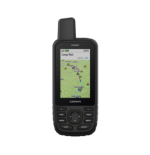
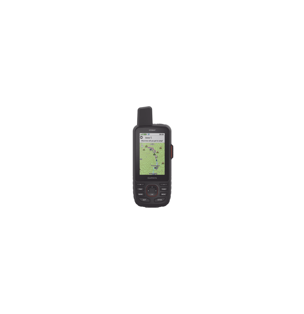
GARMIN 100281200 10-02812-00 GPS portátil GPSMAP 67i dispositivo portátil multisateli
GARMIN 100281200 10-02812-00 GPS portátil GPSMAP 67i dispositivo portátil multisatelital de alta precision con mapas topográficos instalados mensajeria y SOS por medio de Inreach
100281200 GPS portatil GPSMAP 67i, dispositivo portatil multisatelital de alta precision, con mapas topograficos instalados, mensajeria y SOS por medio de Inreach 10-02812-00
GPSMAP® 67i
Dispositivo portátil multisatelital.
Características:
- Pantalla TFT a color legible aún a contra la luz del sol.
- Incluye mapas topográficos instalados.
- Mapas nítidos con gran información y detalles. (incluye mapa base)
- Compatible con los sistema de navegación GPS GLONASS GALILEO QZSS BEIDOU IRNSS
- Memoria interna de 16 GB.
- Función de Inreach
Incluye:
- GPSMAP 67
- Cable USB-A a USB-C
- Batería interna.
- Clip del mosquetón.
- Documentación.
Dimensiones: 6 2 x 16 3 x 3 5 cm (2 5″ x 6 4″ x 1 4″)
Peso: 230g
MAPAS Y MEMORIA.
| MAPAS PREINSTALADOS | Sí (TopoActive de EE. UU. México y Canadá con rutas) |
|---|---|
| POSIBILIDAD DE AGREGAR MAPAS | SI |
| MAPA BASE | SI |
| CREACIÓN AUTOMÁTICA DE RUTAS (GIRO A GIRO EN CARRETERA) | SI |
| SEGMENTOS DEL MAPA | 15000 |
| BIRDSEYE | Sí (directamente al dispositivo) |
| INCLUYE CARACTERÍSTICAS HIDROGRÁFICAS DETALLADAS (LITORALES LÍNEAS DE COSTA DE RÍOS O LAGOS HUMEDALES ARROYOS PERENNES Y ESTACIONALES). | SI |
| INCLUYE BÚSQUEDAS DE PUNTOS DE INTERÉS (PARQUES CAMPINGS MIRADORES PANORÁMICOS Y SITIOS DE PÍCNIC). | SI |
| MUESTRA PARQUES NACIONALES ESTATALES Y LOCALES BOSQUES Y ÁREAS NATURALES. | SI |
| ALMACENAMIENTO Y CAPACIDAD DE CARGA | Sí (tarjeta microSD™ de 32 GB como máximo) |
| WAYPOINTS | 10000 |
| TRAYECTOS | 250 200 puntos de trayecto por trayecto |
| PISTAS | 250 |
| TRACK LOG | 20000 puntos 250 tracks gpx guardados 300 actividades de ejercicio guardadas |
| ACTIVIDADES | Sí |
| RUTAS | 250 250 puntos por ruta; 50 puntos de rutas automáticas |
SENSORES
| ECEPTOR DE ALTA SENSIBILIDAD | SI |
|---|---|
| GPS | SI |
| GLONASS | SI |
| GALILEO | SI |
| QZSS | SI |
| BEIDOU | SI |
| IRNSS | SI |
| ALTÍMETRO BAROMÉTRICO | SI |
| BRÚJULA | Sí (tres ejes con inclinación compensada) |
| BRÚJULA GPS (MIENTRAS SE ESTÁ EN MOVIMIENTO) | SI |
| FRECUENCIA MULTIBANDA | SI |
FUNCIONES PARA ACTIVIDADES DE OCIO Y AL AIRE LIBRE
| AVEGACIÓN PUNTO A PUNTO | SI |
|---|---|
| TRACBACK® | SI |
| CÁLCULO DE ÁREAS | SI |
| CALENDARIO DE CAZA Y PESCA | SI |
| INFORMACIÓN ASTRONÓMICA | SI |
| XERO™ LOCATIONS | SI |
| MODO GEOCACHING | Sí (geocachés en directo)< |
10-02812-00 GPS portatil GPSMAP 67i, dispositivo portatil multisatelital de alta precision, con mapas topograficos instalados, mensajer
6 otros productos de la misma categoría:
Comentarios (0)
Su agradecimiento a la reseña no pudo ser enviado
Reportar comentario
¿Está seguro de que quiere denunciar este comentario?
Reporte enviado
Su reporte ha sido enviado y será considerada por un moderador.
Su reporte no pudo ser enviado
Escribe tu opinión
Reseña enviada
Su comentario ha sido añadido y estará disponible una vez sea aprobado por un moderador.
Su reseña no pudo ser enviada
GARMIN 100281200 10-02812-00 GPS portátil GPSMAP 67i dispositivo portátil multisatelital de alta precision con mapas topográficos instalados mensajeria y SOS por medio de Inreach


